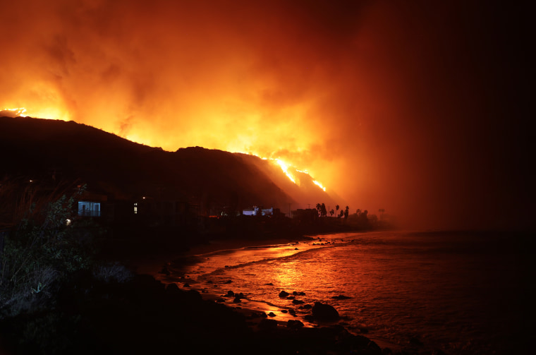
A resurgence in offshore wind is expected to keep fire risk high across the region through Friday morning, according to the National Oceanic and Atmospheric Administration’s Storm Prediction Center.
Santa Ana winds, which gain speed as they blow west and downslope from the Great Basin, are typical at this time of year. But conditions are not normally bone-dry when the winds gust through the mountains of Southern California toward the Pacific coast.
“Normally everything would be wet by now, which means there would be much less of a chance of an ignition leading to a big fire that gets out of control like what we’re seeing now,” Moritz said.
More than 15,000 acres have already burned in the Palisades Fire. The Eaton fire, which sparked Tuesday evening in the Pasadena and Altadena area, has engulfed over 10,000 acres. In Sylmar, the Hurst Fire has also grown to 500 acres, according to the California Department of Forestry and Fire Protection (Cal Fire).
All three fires are at 0% containment, and firefighting efforts have faced challenging conditions with ongoing high winds.
Such devastating blazes are expected to become more frequent as climate change amplifies the ingredients that help wildfires ignite and spread. Almost all of California’s largest wildfires have occurred in the last decade, according to Cal Fire.
Fires are typically fueled by hot, dry and windy conditions. Moritz said there is not enough research yet to know whether if climate change is altering winds in any significant way, but he said global warming is already having an impact on rainfall and drought.

“Climate change is leading to more erratic and extreme precipitation patterns,” he said. “That effect on precipitation is very important, because we’re having wetter wet periods and drier dry periods, and overall, we’re seeing this very erratic timing of precipitation.”
That means a region like Southern California could be hammered by severe flooding at one point, as it was in March, and then months later descend into drought. Lurching between those extremes puts people and their communities at heightened risk, Moritz said.
“That’s the climate signal in all of this — that we’ve opened this window where we can get these big, devastating extreme events now,” he said.


